
Tập tin:Tierra del Fuego location map.svg

Tập tin gốc (tập tin SVG, 1.535×1.550 điểm ảnh trên danh nghĩa, kích thước: 824 kB)
Tập tin này từ Wikimedia Commons. Trang miêu tả nó ở đấy được sao chép dưới đây. Commons là kho lưu trữ tập tin phương tiện có giấy phép tự do. Bạn có thể tham gia. |
Miêu tả
| Miêu tả |
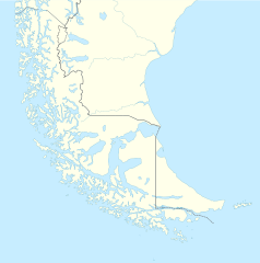
Deutsch: Positionskarte von Feuerland und Umgebung
Quadratische Plattkarte, N-S-Streckung 160 %. Geographische Begrenzung der Karte:
English: Location map of Tierra del Fuego and surroundings
Equirectangular projection, N/S stretching 160 %. Geographic limits of the map:
Español: Ubicación de Tierra del Fuego y alrededores
Proyección equirectangular, N/S 160% de estiramiento. Límites geográficos del mapa:
|
|
| Ngày | ||
| Nguồn gốc |
Tác phẩm được tạo bởi người tải lên, using
|
|
| Tác giả | NordNordWest | |
| Giấy phép (Dùng lại tập tin) |
Tập tin này được phát hành theo giấy phép Creative Commons Ghi công–Chia sẻ tương tự 3.0 Đức.
 Tập tin này được phát hành theo giấy phép Creative Commons Ghi công–Chia sẻ tương tự 3.0 Đức.
|
|
| Phiên bản khác |
Derivative works of this file: |

.svg)

|
This map has been made or improved in the German Kartenwerkstatt (Map Lab). You can propose maps to improve as well.
|
Lịch sử tập tin
Nhấn vào ngày/giờ để xem nội dung tập tin tại thời điểm đó.
| Ngày/giờ | Hình xem trước | Kích cỡ | Thành viên | Miêu tả | |
|---|---|---|---|---|---|
| hiện tại | 16:20, ngày 5 tháng 3 năm 2024 | | 1.535×1.550 (824 kB) | Janitoalevic | More specific Beagle Channel |
| 01:23, ngày 29 tháng 12 năm 2022 |  | 1.535×1.550 (588 kB) | Janitoalevic | Improved borders | |
| 19:41, ngày 3 tháng 5 năm 2020 |  | 1.535×1.550 (566 kB) | Janitoalevic | Improved Isla de los Estados | |
| 18:47, ngày 3 tháng 5 năm 2020 |  | 1.535×1.550 (558 kB) | Janitoalevic | Improved | |
| 23:23, ngày 29 tháng 8 năm 2017 |  | 1.535×1.550 (441 kB) | Janitoalevic | Fixed size | |
| 11:23, ngày 29 tháng 8 năm 2017 |  | 1.535×1.550 (510 kB) | NordNordWest | Reverted to version as of 20:59, 15 March 2016 (UTC); change of size is catastrophic to some templates | |
| 22:18, ngày 28 tháng 8 năm 2017 |  | 1.638×1.653 (442 kB) | Janitoalevic | More precise borders and lakes | |
| 20:59, ngày 15 tháng 3 năm 2016 |  | 1.535×1.550 (510 kB) | Janitoalevic | Fixed limits following Google Earth/maps limits | |
| 22:12, ngày 2 tháng 3 năm 2016 |  | 1.535×1.550 (510 kB) | Janitoalevic | Updated | |
| 20:34, ngày 11 tháng 9 năm 2015 |  | 1.535×1.550 (508 kB) | Janitoalevic | Added Southern Patagonian Ice Field (Campo de hielo Patagónico Sur) undefined limits part, since 1998 For more information read: https://en.wikipedia.org/wiki/Southern_Patagonian_Ice_Field#Borderline Now with full resolution. |
Trang sử dụng tập tin
Sử dụng tập tin toàn cục
Những wiki sau đang sử dụng tập tin này:
- Trang sử dụng tại als.wikipedia.org
- Trang sử dụng tại ar.wikipedia.org
- Trang sử dụng tại az.wikipedia.org
- Trang sử dụng tại ba.wikipedia.org
- Trang sử dụng tại bn.wikipedia.org
- Trang sử dụng tại ceb.wikipedia.org
- Trang sử dụng tại cs.wikipedia.org
- Trang sử dụng tại da.wikipedia.org
- Trang sử dụng tại de.wikipedia.org
- Trang sử dụng tại el.wikipedia.org
- Trang sử dụng tại en.wikipedia.org
- Tierra del Fuego
- Ushuaia – Malvinas Argentinas International Airport
- Isla Grande de Tierra del Fuego
- Puerto Williams
- Río Grande, Tierra del Fuego
- Diego Ramírez Islands
- Riesco Island
- Hoste Island
- Viedma (volcano)
- Cerro Torre
- Fitz Roy
- Viedma Lake
- Gallegos River
- Mount Darwin (Andes)
- Puerto Toro
- Dawson Island
- Ildefonso Islands
- Hermite Islands
- Southern Patagonian Ice Field
- Navarino Island
- Cordillera Darwin
- Cordillera Sarmiento
- Londonderry Island
- Hornos Island
- Grey Lake
- Desolación Island
- Clarence Island, Chile
- Gordon Island
- Juan Guillermos Island
Xem thêm các trang toàn cục sử dụng tập tin này.