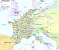
Tập tin:Map administrative divisions of the First French Empire 1812-en.svg
Giao diện

Kích thước bản xem trước PNG này của tập tin SVG: 712×600 điểm ảnh. Độ phân giải khác: 285×240 điểm ảnh | 570×480 điểm ảnh | 912×768 điểm ảnh | 1.216×1.024 điểm ảnh | 2.432×2.048 điểm ảnh | 2.052×1.728 điểm ảnh.
Tập tin gốc (tập tin SVG, 2.052×1.728 điểm ảnh trên danh nghĩa, kích thước: 4,14 MB)
Lịch sử tập tin
Nhấn vào ngày/giờ để xem nội dung tập tin tại thời điểm đó.
| Ngày/giờ | Hình xem trước | Kích cỡ | Thành viên | Miêu tả | |
|---|---|---|---|---|---|
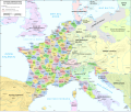
| hiện tại | 16:55, ngày 16 tháng 6 năm 2024 |  | 2.052×1.728 (4,14 MB) | 밥풀떼기 | File uploaded using svgtranslate tool (https://svgtranslate.toolforge.org/). Added translation for ko. |
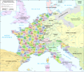
| 12:33, ngày 9 tháng 2 năm 2024 |  | 2.052×1.728 (3,86 MB) | Manlleus | added catalan language | |
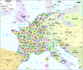
| 17:10, ngày 21 tháng 5 năm 2021 |  | 2.052×1.728 (3,55 MB) | Andrei Stroe | File uploaded using svgtranslate tool (https://svgtranslate.toolforge.org/). Added translation for ro. | |
| 12:32, ngày 30 tháng 8 năm 2020 |  | 2.052×1.728 (3,24 MB) | Jfblanc | File uploaded using svgtranslate tool (https://svgtranslate.toolforge.org/). Added translation for oc. | |
| 10:37, ngày 1 tháng 3 năm 2018 |  | 2.052×1.728 (2,83 MB) | Imperator Honorius | Formatting Fix | |
| 10:29, ngày 1 tháng 3 năm 2018 |  | 2.052×1.728 (2,83 MB) | Imperator Honorius | Formatting and missing Anglicization (Gand to Ghent) | |
| 10:17, ngày 1 tháng 3 năm 2018 |  | 2.052×1.728 (2,83 MB) | Imperator Honorius | Spelling and typos; more Anglicised (and up to date) city names. | |
| 19:41, ngày 20 tháng 7 năm 2015 |  | 2.052×1.728 (2,82 MB) | ArdadN | spelling | |
| 17:11, ngày 20 tháng 7 năm 2015 |  | 2.052×1.728 (2,81 MB) | ArdadN | 1 | |
| 17:05, ngày 20 tháng 7 năm 2015 |  | 2.052×1.728 (2,81 MB) | ArdadN | font size |
Trang sử dụng tập tin
Có 3 trang tại Wikipedia tiếng Việt có liên kết đến tập tin (không hiển thị trang ở các dự án khác):
Sử dụng tập tin toàn cục
Những wiki sau đang sử dụng tập tin này:
- Trang sử dụng tại af.wikipedia.org
- Trang sử dụng tại ar.wikipedia.org
- Trang sử dụng tại ca.wikipedia.org
- Trang sử dụng tại en.wikipedia.org
- History of the Netherlands
- 1810s
- Departments of France
- 130 departments of the First French Empire
- Illyrian Provinces
- Kingdom of Italy (Napoleonic)
- Portal:Maps/Maps/Political
- Portal:Maps/Maps/Political/14
- First French Empire
- Bouches-del'Èbre
- Department of Segre
- Left Bank of the Rhine
- Portal:Maps
- User:Dakaysaa/sandbox
- User:Falcaorib/France
- Trang sử dụng tại et.wikipedia.org
- Trang sử dụng tại fr.wikipedia.org
- Trang sử dụng tại hr.wikipedia.org
- Trang sử dụng tại it.wikipedia.org
- Trang sử dụng tại ka.wikipedia.org
- Trang sử dụng tại km.wikipedia.org
- Trang sử dụng tại krc.wikipedia.org
- Trang sử dụng tại mt.wikipedia.org
- Trang sử dụng tại no.wikipedia.org
- Trang sử dụng tại pl.wikipedia.org
- Trang sử dụng tại pnb.wikipedia.org
- Trang sử dụng tại pt.wikipedia.org
- Trang sử dụng tại ru.wikipedia.org
- Trang sử dụng tại tr.wikipedia.org
- Trang sử dụng tại ur.wikipedia.org


